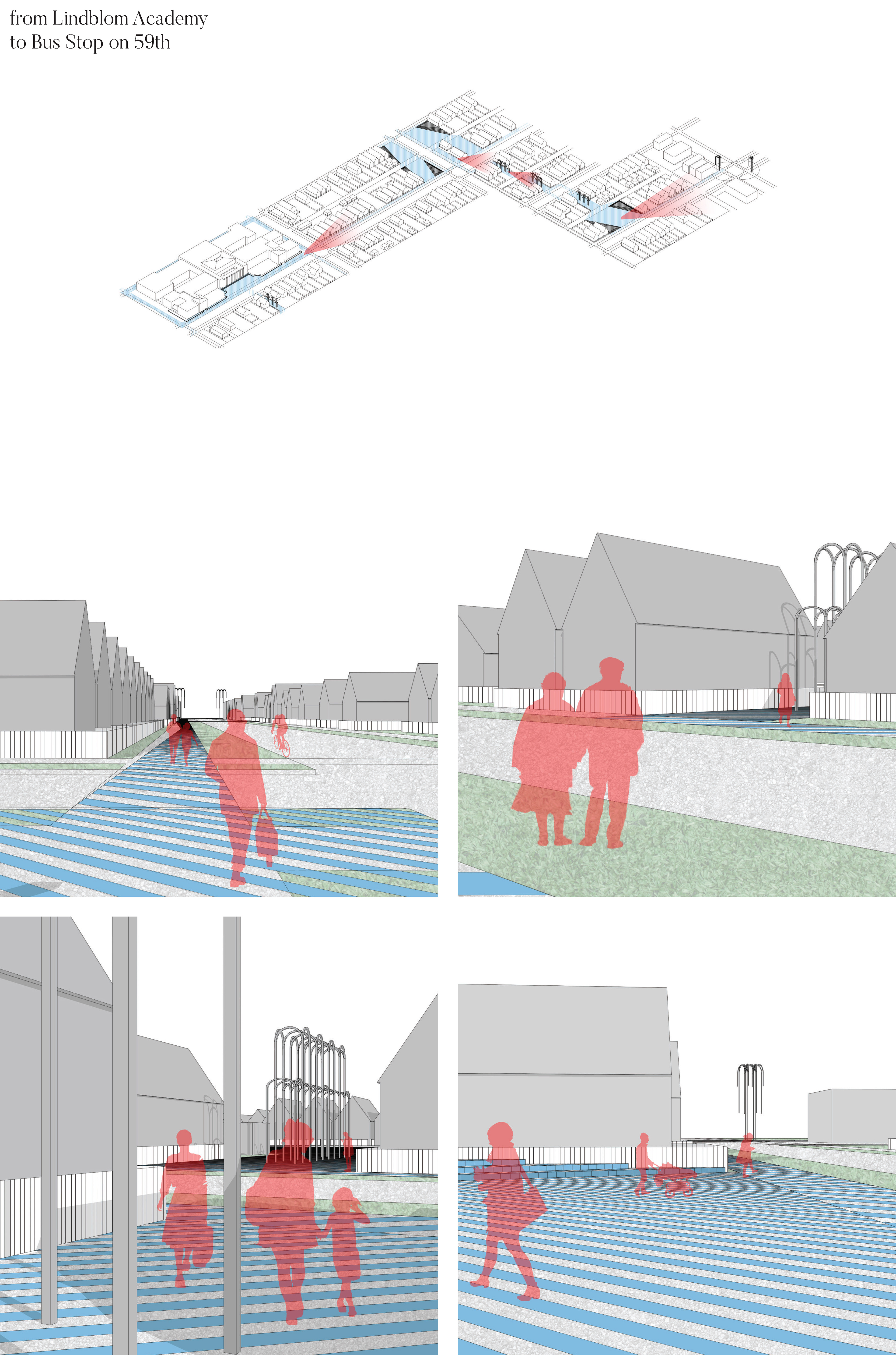
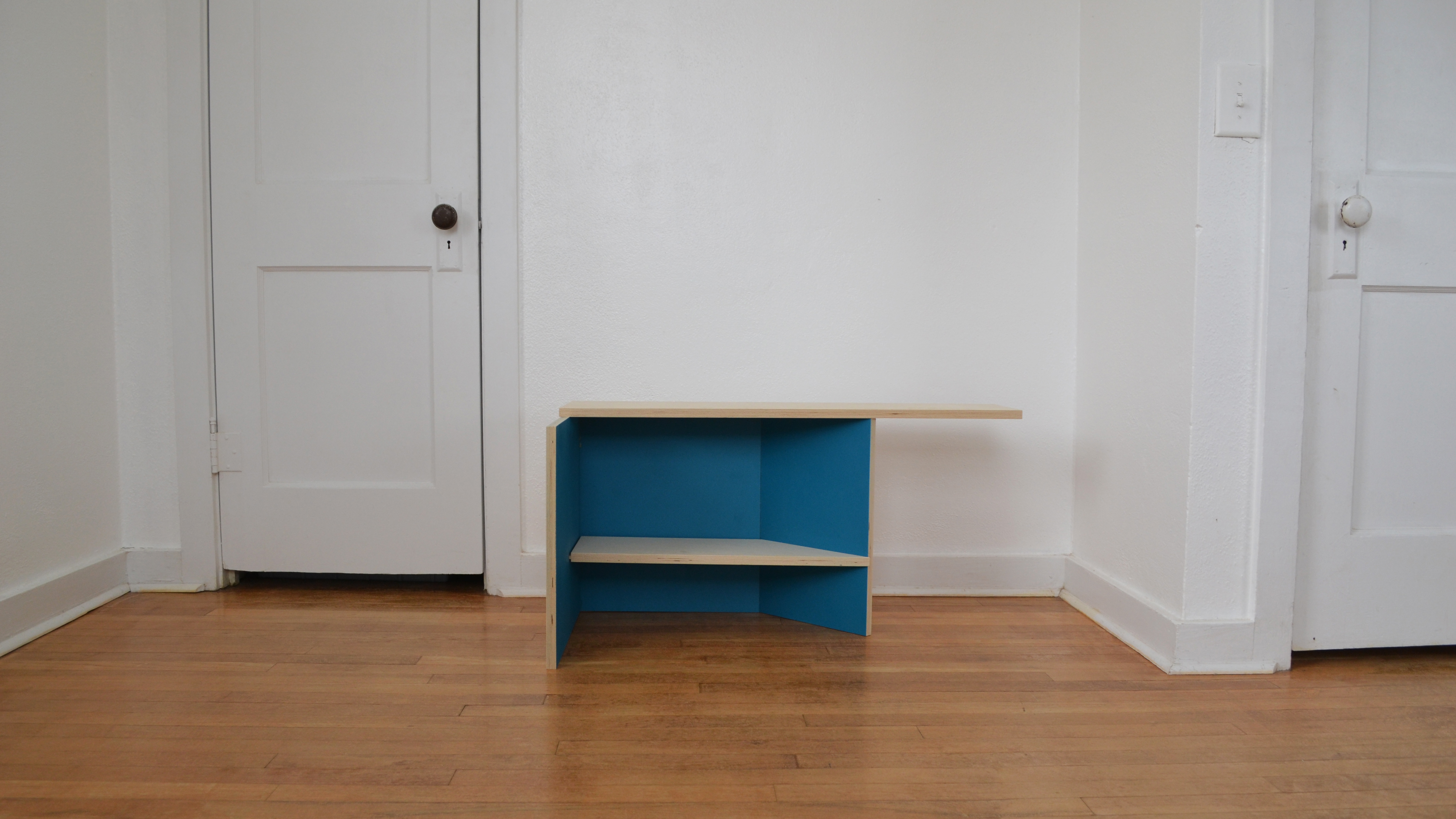
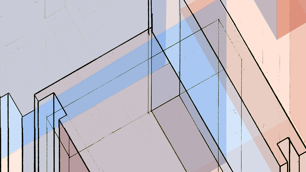
Plan Oblique of Neighborhood Intervention around Lindblom Academy of Math & Science.
This advanced design studio from the Fall semester of 2019 was taught under the lead of Piergianna Mazzocca and was a research-based approach to understanding the medicalization of architecture and its effects on public health in the city of Chicago, IL.
The semester began with research on a specific typology within a group, then breaking off into individual projects based on personal interests and additional research. For my project, we looked at public schools and their safety concerns in relation to boundaries and thresholds. We then focused more on one public high school, Lindblom Academy of Math and Sciences in the South Side of Chicago. I chose this school because of its unique location and the organization of the neighborhood around it. This area I specifically focused on is bounded by from Damen/Ashland and 59th/63rd Streets.
The semester began with research on a specific typology within a group, then breaking off into individual projects based on personal interests and additional research. For my project, we looked at public schools and their safety concerns in relation to boundaries and thresholds. We then focused more on one public high school, Lindblom Academy of Math and Sciences in the South Side of Chicago. I chose this school because of its unique location and the organization of the neighborhood around it. This area I specifically focused on is bounded by from Damen/Ashland and 59th/63rd Streets.
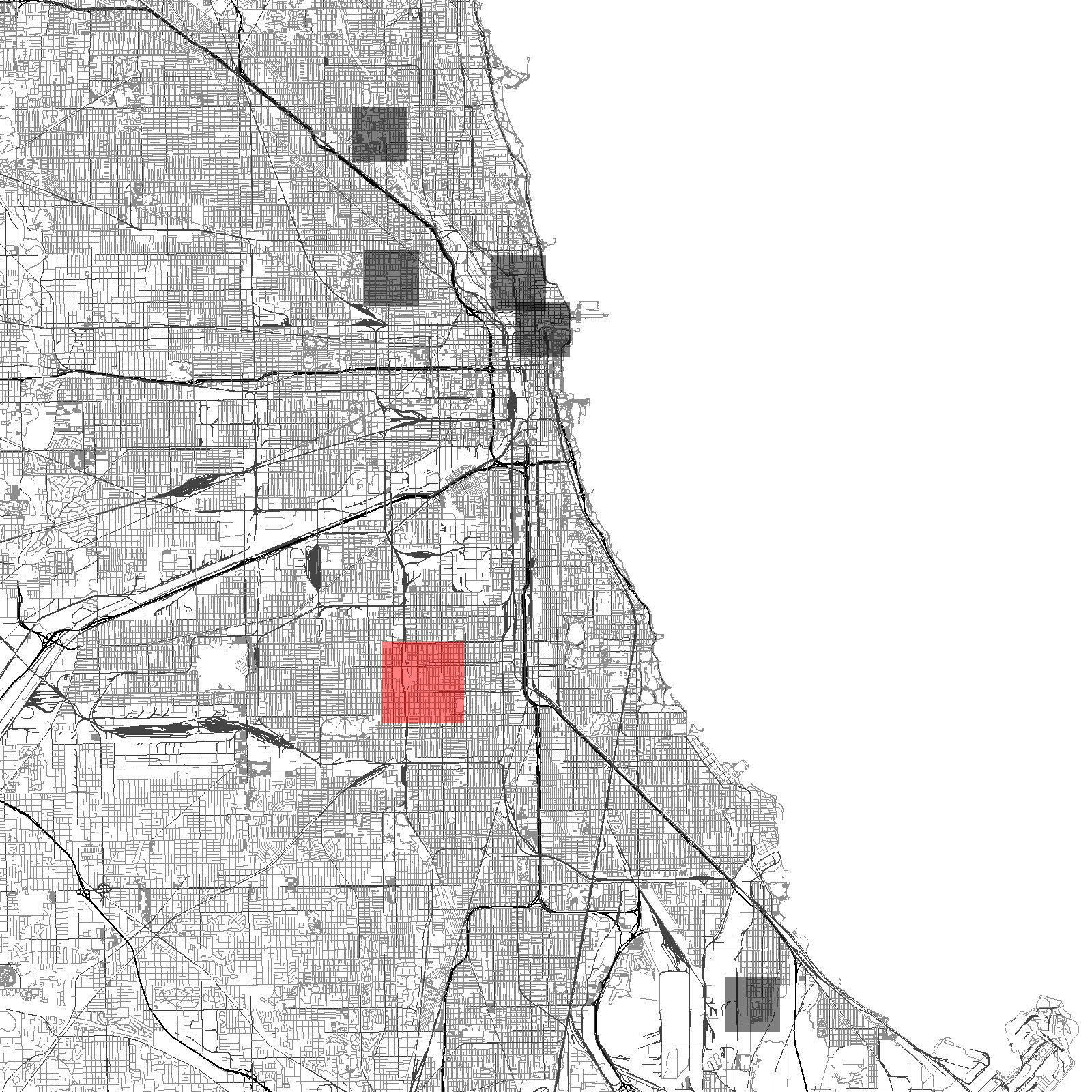
City of Chicago with studied schools noted, chosen option in red.
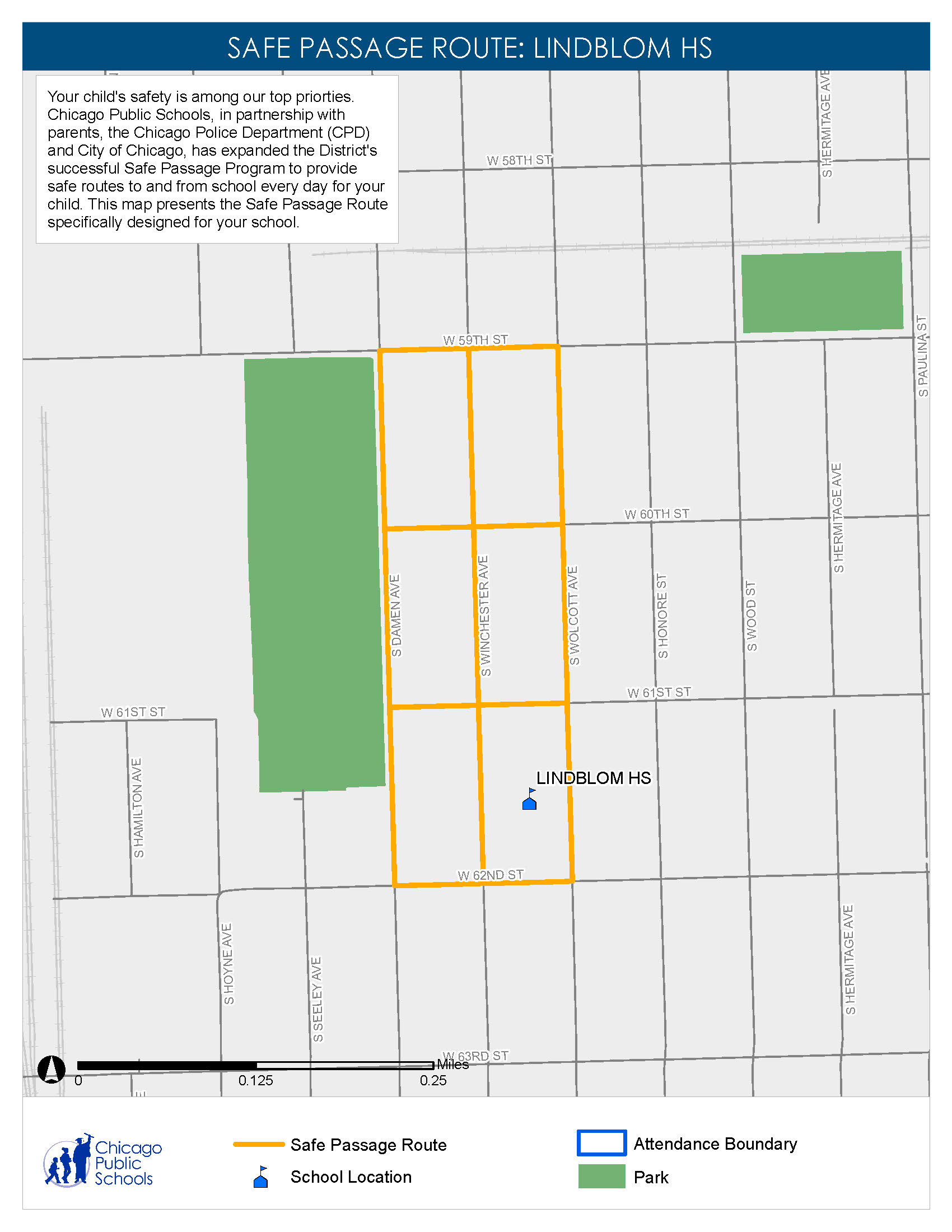
Example of existing safe passage program for chosen site from Chicago Public Schools.
Most people feel safer when they are both seeing their surroundings clearly and being seen by others in a public space. The main goal of this intervention is to create a wayfinding system for this neighborhood, specifically, that focuses on connecting students to their schools and preferred method of getting to school. This explored the possibility of using utilitarian and community policing principles instead of an imposing patrol like the one that is currently in place. The result is a series of objects of visibility. The whole idea for this project specifically is to have the members of the neighborhood look after each other; the person inside the house can look out of their window and see a passage route next to them and know if something has gone wrong and when to call for help, and the person walking through the space is aware that they are in close proximity to someone’s home and is either fully aware someone can see them or only perceiving that someone is.
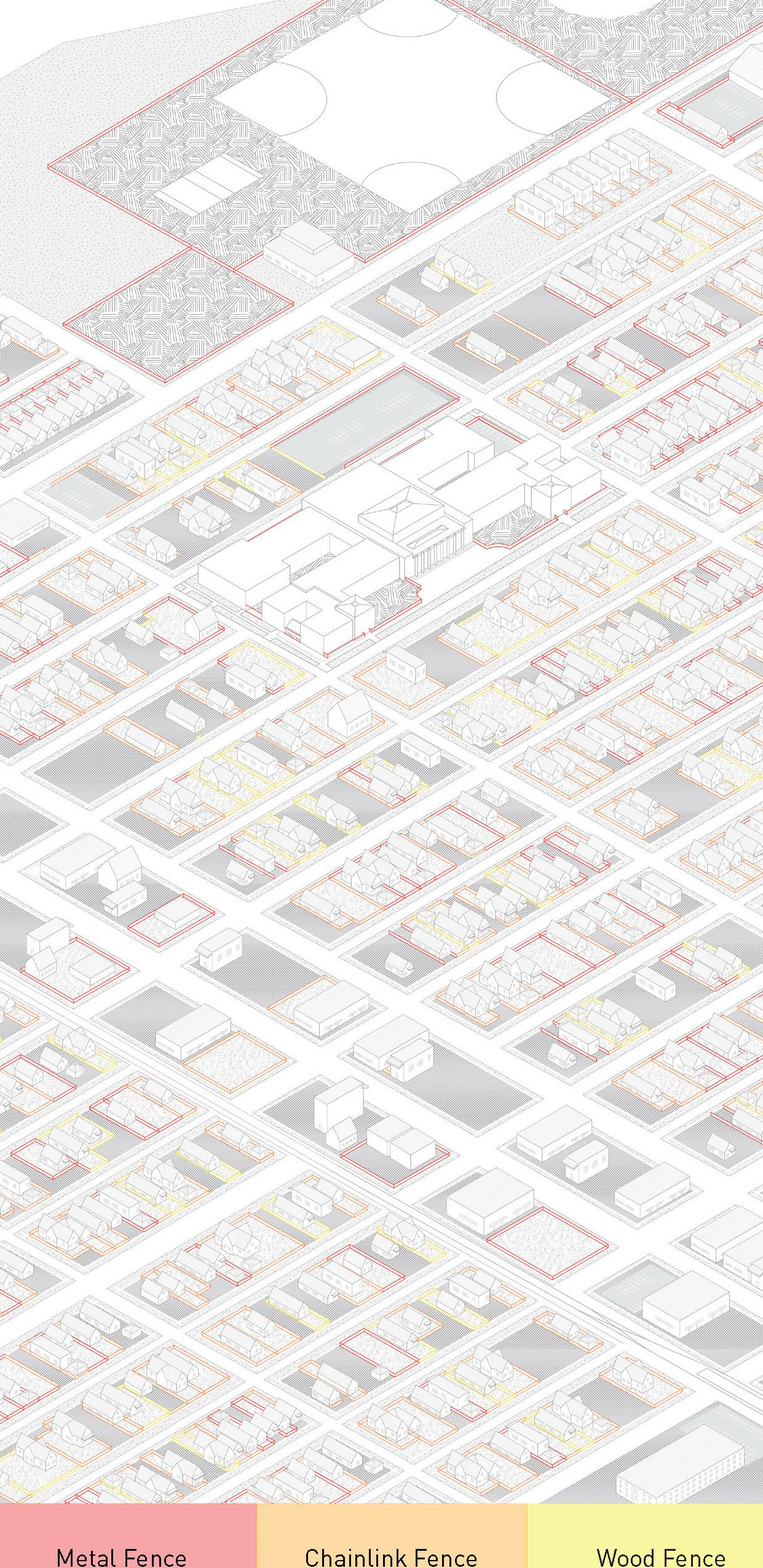
Diagram of neighborhood homes based on fence types.

Map of neighborhood based on police crime records over a six week period.
Assumption
These dedicated “safe passage routes” exist between major transit stops and the school itself and are only an outline for the presence of untrained adult monitors patrolling the streets.
These dedicated “safe passage routes” exist between major transit stops and the school itself and are only an outline for the presence of untrained adult monitors patrolling the streets.
Position
These rigidly defined corridors make a marginal difference at best in keep students safe while moving to and from school. There are ways to design the experience of these safe passage routes and provide a noticeably different walk to school, one in which there is an adequate illusion of safety and not a hard boundary on where it is ‘safe’ to walk and where it is ‘not.’
These rigidly defined corridors make a marginal difference at best in keep students safe while moving to and from school. There are ways to design the experience of these safe passage routes and provide a noticeably different walk to school, one in which there is an adequate illusion of safety and not a hard boundary on where it is ‘safe’ to walk and where it is ‘not.’
Implication
There are built components, infrastructural improvements, and wayfinding methods that can be implemented and provide a safe walk to or from school for students, without the direct and looming imposition of a neighborhood patrol to escort them. These implications fit in a system that is mostly on the scale of urban planning and can be placed wherever they are needed.
There are built components, infrastructural improvements, and wayfinding methods that can be implemented and provide a safe walk to or from school for students, without the direct and looming imposition of a neighborhood patrol to escort them. These implications fit in a system that is mostly on the scale of urban planning and can be placed wherever they are needed.
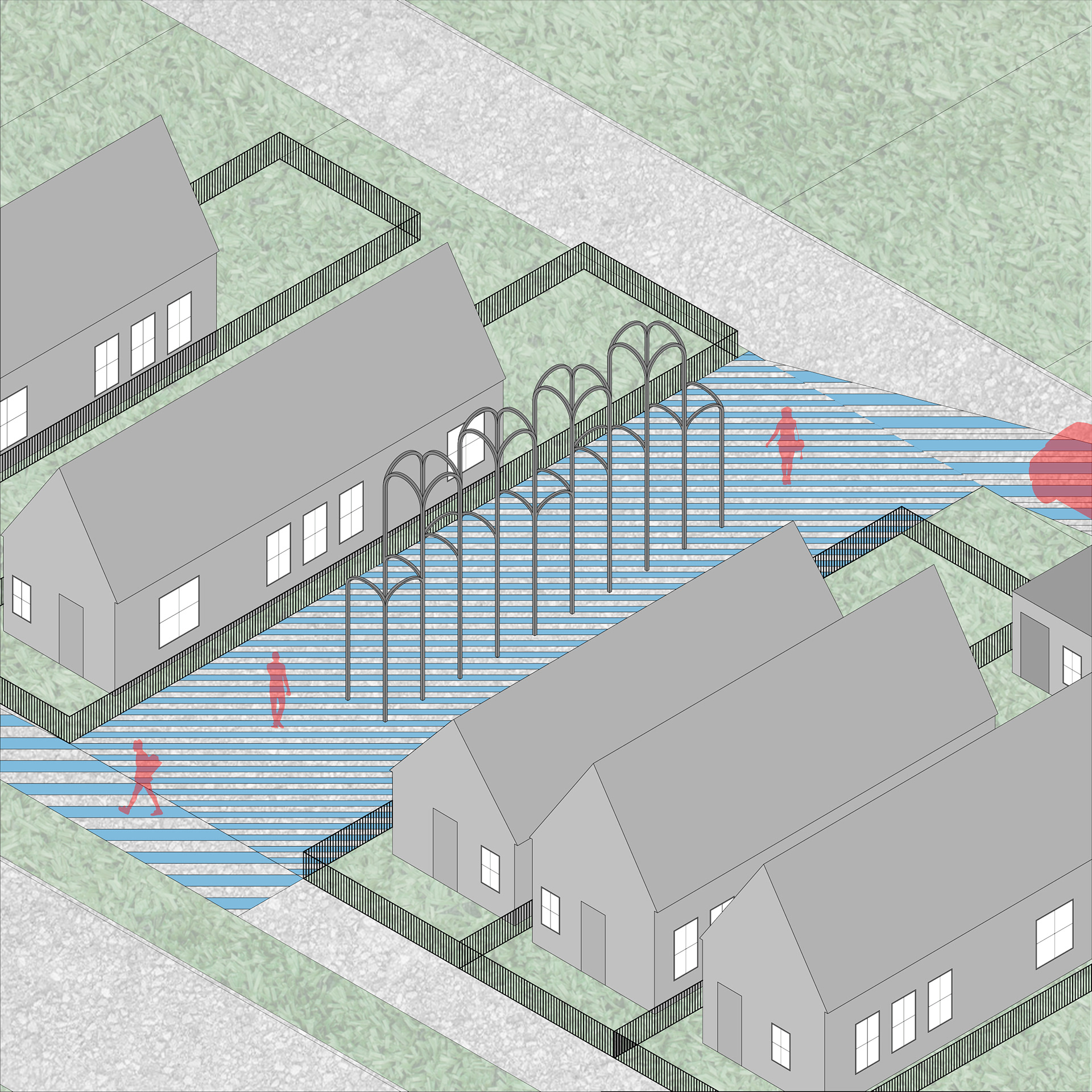
Single Lot with arches.
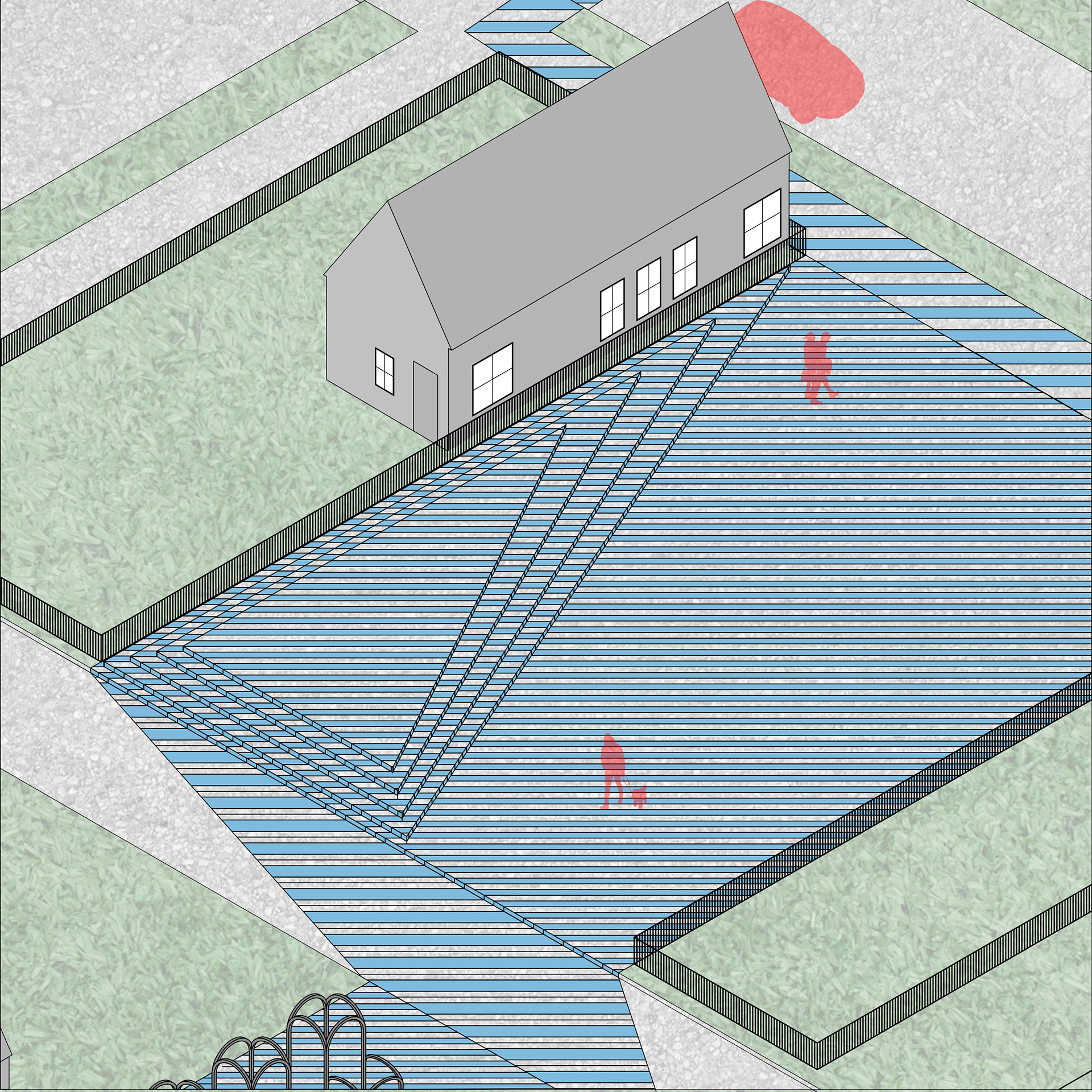
Stepped Platform.
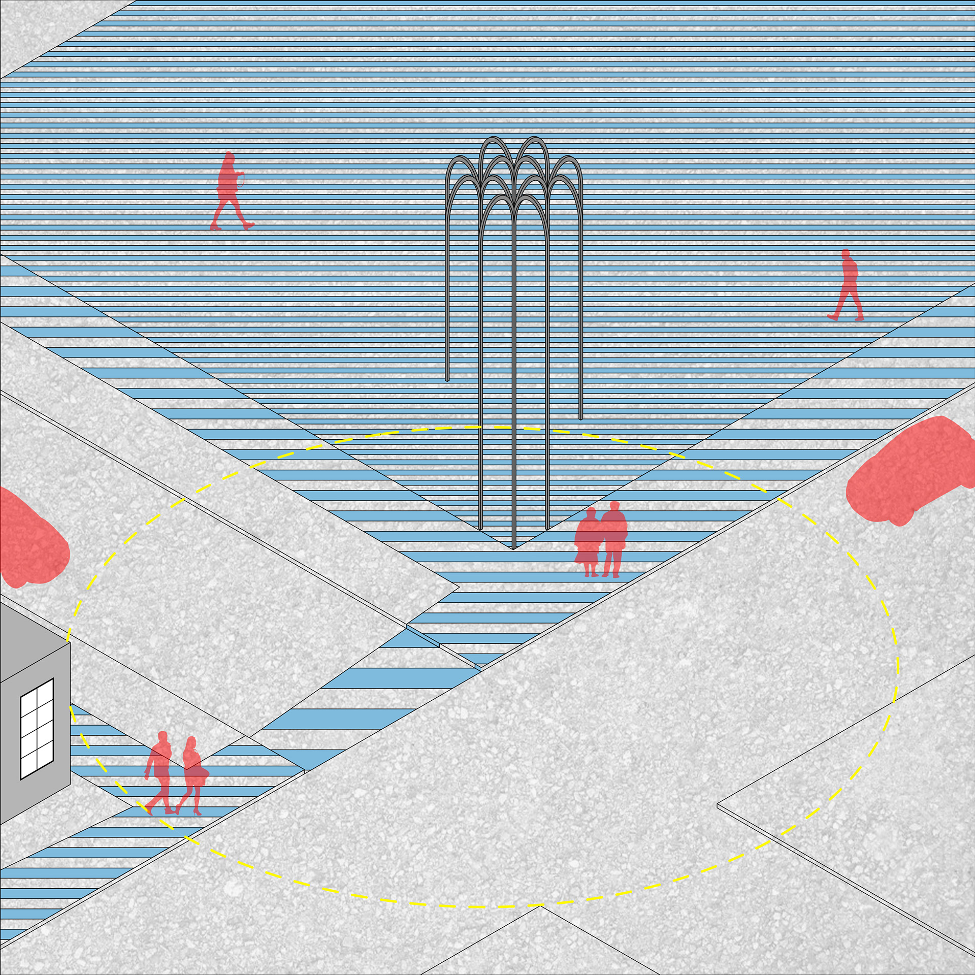
Corner lot with transit stop.
These tools include platforms and arches that delineate a direction to walk in, and markings on the ground that increase in density on empty lots between residences or in highly public corridors and decrease in street crossings and become more narrow on single-through empty lots to encourage movement.
Surface pattern detail.
The platforms point in the direction of movement and aim to gently nudge the user in the direction of continuing condition. The platforms remain blue year round for visibility. The arches are tall enough to be seen from one to two streets away. The transit markers are in a similar language for wayfinding, but stand much taller and peer out over the sidewalk to be seen from even greater distances. The arches are made of mirrors and touch down slightly and remain thin in profile so as to decrease the chance of someone hiding behind one or jumping out and surprising you. Sidewalk patterns and projections become denser and more colorful in the spaces of the empty lots to show that more time can be spent moving through the area, as opposed to heavier and wider lines in alleys and streets.
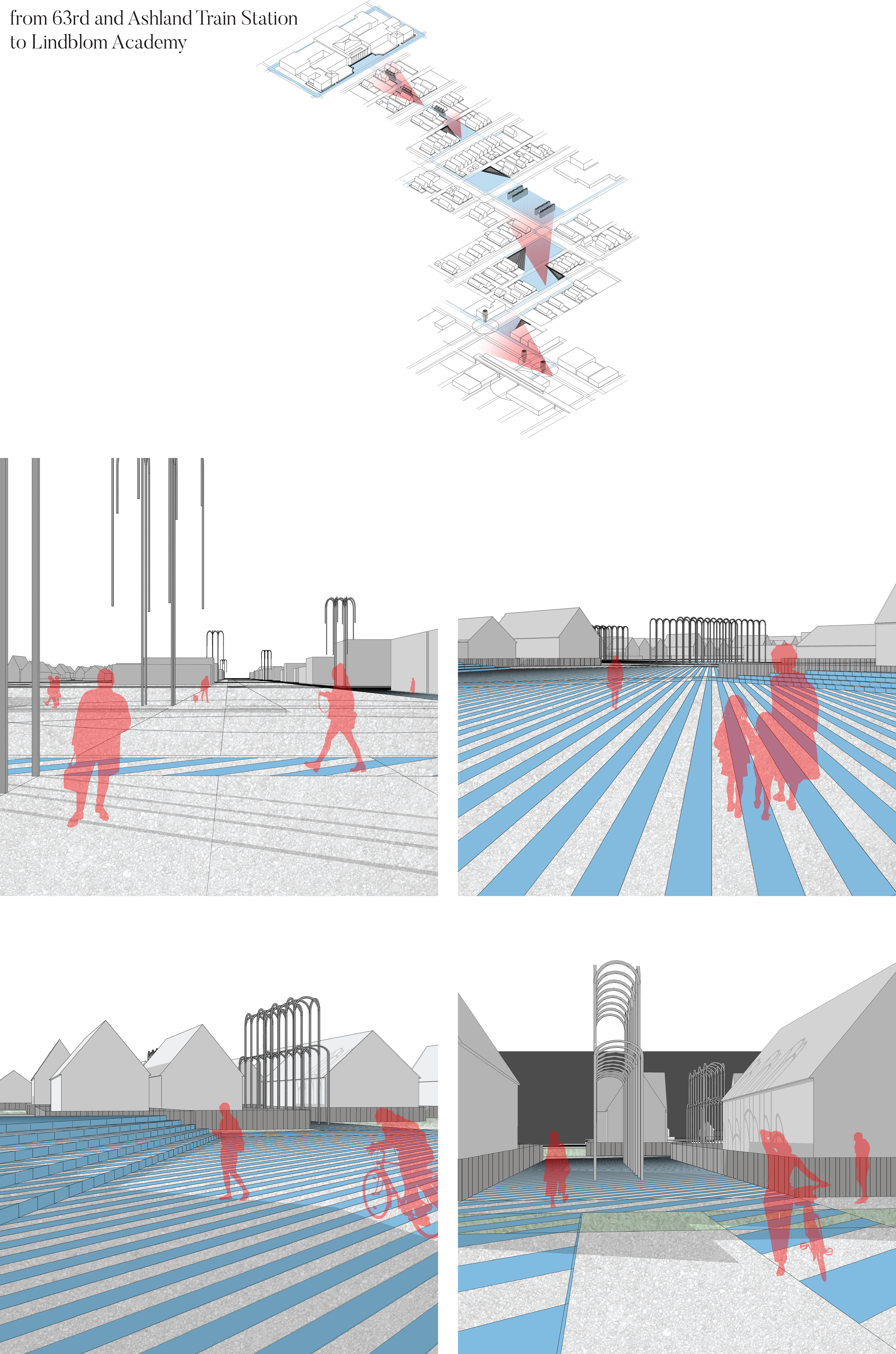
Route vignette from train station to school.
